NATO’s maritime forces operate in waters that are crowded, contested and increasingly shaped by technology. Sea lines of communication remain vulnerable. Critical infrastructure lies exposed on and below the seabed. Mines, autonomous systems, commercial shipping and military forces may all occupy the same operating area.
These conditions place greater demands on commanders and crews. They need reliable environmental information, a clear picture above and below the surface, systems that can exchange data, and procedures that allow forces from different nations to act together.
Five NATO-accredited Centres of Excellence bring focused expertise to these challenges. The Confined and Shallow Waters (CSW), Maritime Security, Maritime Geospatial, Meteorological and Oceanographic (MGEOMETOC), Naval Mine Warfare (NMW), and Combined Joint Operations from the Sea (CJOS) Centres of Excellence each approach the maritime domain from a different direction. Their work supports NATO’s ability to understand the operating environment, prepare its forces and adapt to changing threats.
Understanding the Waters Where NATO Operates
The physical environment shapes every maritime operation. Weather affects aviation and sensor performance. Currents influence mine movement and underwater activity. Coastal terrain, water depth and seabed conditions can determine where forces can safely operate.
The Maritime Geospatial, Meteorological and Oceanographic Centre of Excellence helps NATO turn this environmental information into practical support for commanders.
At the annual Robotic Experimentation and Prototyping with Maritime Unmanned Systems exercise, known as REPMUS, the Centre coordinates the Rapid Environmental Assessment syndicate. This work explores how new technologies can collect, process and share information about the maritime environment during an operation.
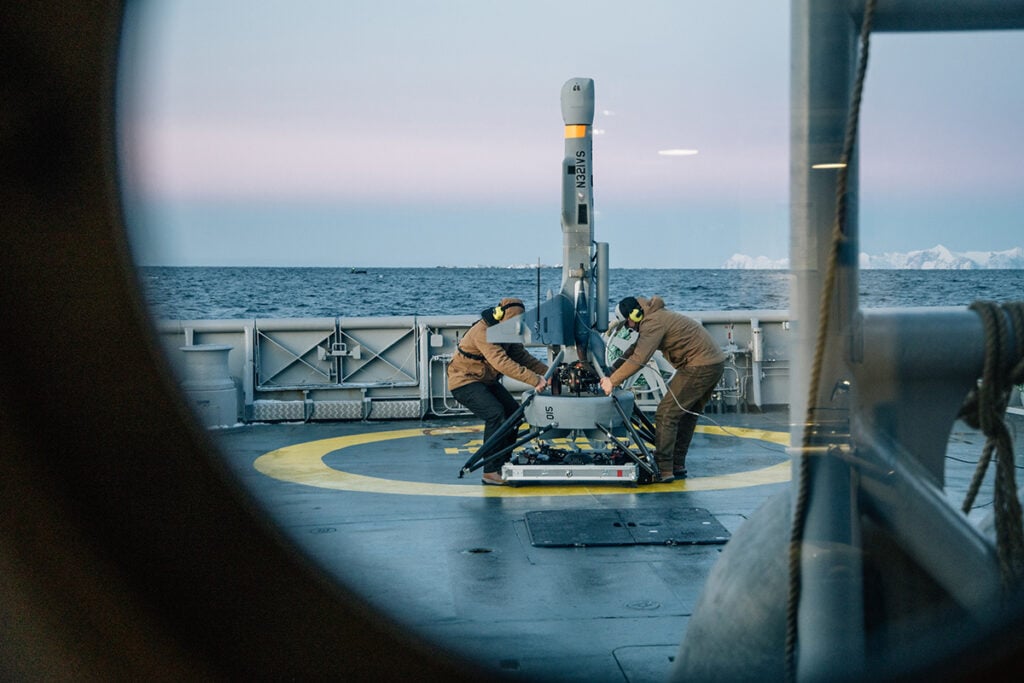
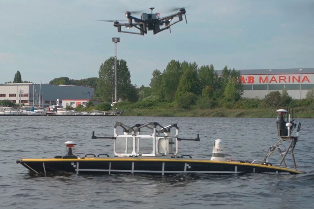
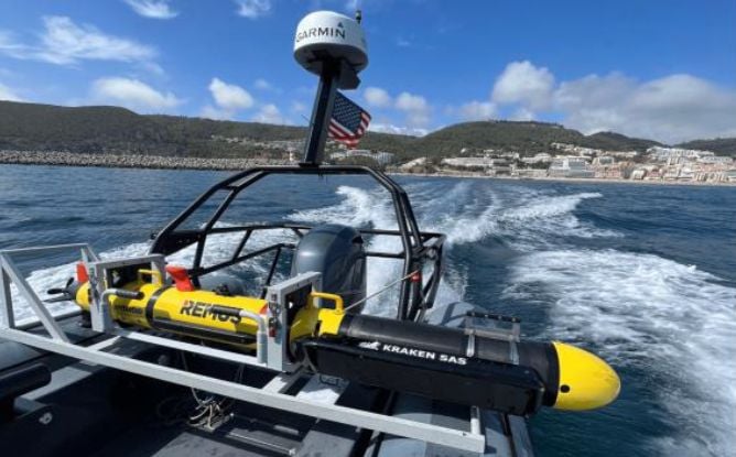
Recent trials have included maritime uncrewed systems carrying LiDAR sensors to survey intertidal zones, detect submerged objects and improve coverage from sea to shore. A meteorological drone planned for REPMUS 2026 will provide near-real-time observations in NATO-standard formats for naval forces.
The Centre also works on the standards that allow environmental information to move between Allied systems. Through Federated Mission Networking, it leads efforts to define requirements for sharing meteorological and oceanographic data. At CWIX, it co-leads the GEOMETOC Focus Area and tests how that information can be discovered, accessed and displayed across NATO and national networks.
Doctrine gives this work staying power. The Centre is restructuring NATO procedures for military oceanography and Rapid Environmental Assessment while contributing to publications on data formats, space weather, amphibious operations and environmental support to joint forces.
Preparing for Operations Close to Shore
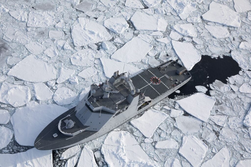
Confined and shallow waters create a different set of demands. Straits, archipelagos, ports and coastal areas leave little room for manoeuvre. Civilian shipping, infrastructure and military activity often overlap. Threats may come from the shore, the surface, beneath the water or overhead.
The Confined and Shallow Waters Centre of Excellence concentrates on these demanding environments. Its experience in the Baltic Sea provides lessons that can be applied to other congested maritime regions.
The Centre develops concepts and doctrine, but it also gives commanders a place to test them. Its tactical maritime wargaming allows staffs to rehearse difficult littoral scenarios, compare courses of action and expose weaknesses before a live exercise or deployment. Distance-learning courses extend that expertise to personnel who cannot attend residential training.
As NATO’s Department Head for Maritime Operations, the Centre helps turn identified training needs into courses, exercises and wargames. This role connects operational lessons with the education and training delivered across the Alliance.
Its work has also produced concrete operational guidance. ATP-94, Harbour Protection, established NATO’s first common procedure for protecting warships in civilian ports against asymmetric and terrorist threats.
The Centre is now developing a Multi-Sensor Data Fusion Cell that combines information from space-based, airborne, surface and subsurface sensors. A prototype has already been tested in live exercises. The goal is a clearer picture of coastal waters where military activity may be difficult to separate from everyday maritime traffic and decisions often need to be made quickly.
Building a Clearer Picture Below the Surface
Some of the most serious maritime threats are difficult to see.
Sea mines remain relatively inexpensive, widely available and capable of closing ports, restricting naval movement and disrupting commercial shipping. A mine does not need to sink a vessel to have strategic effect. The possibility that mines are present can delay operations and force ships onto different routes.
The Naval Mine Warfare Centre of Excellence provides NATO with dedicated expertise in mine warfare doctrine, policy, experimentation, capability development, education and training.
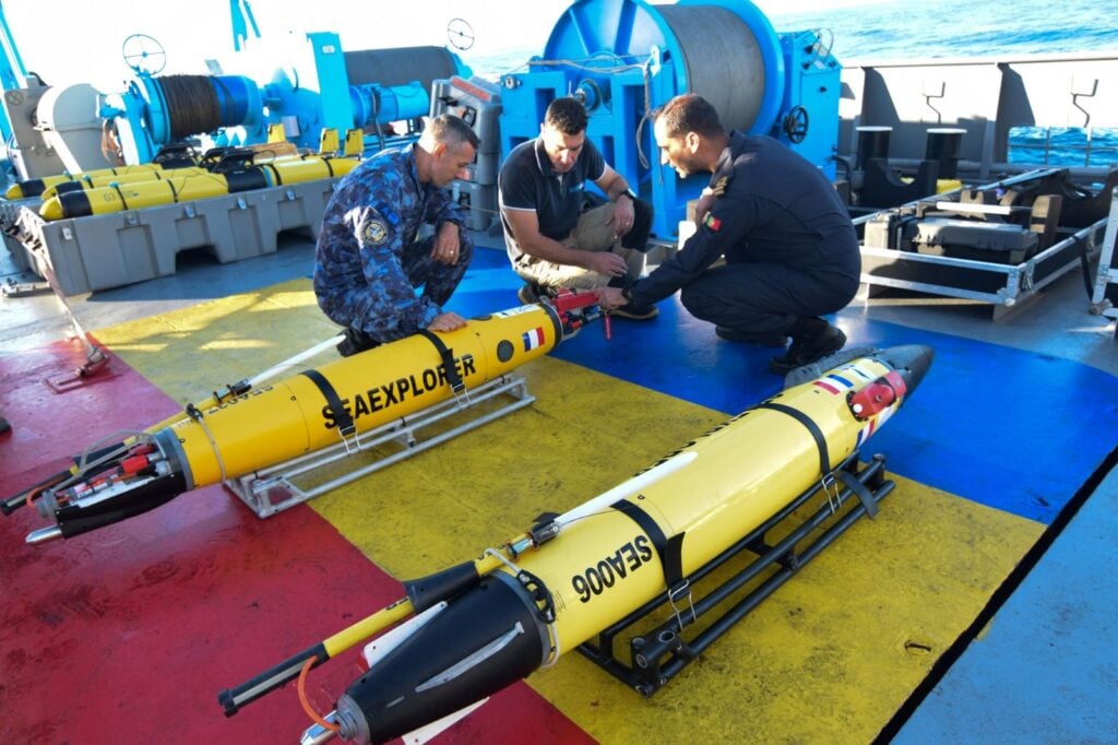
REPMUS gives the Centre an opportunity to test emerging approaches in realistic conditions. Its work there includes experimental tactics for assessing the risk that remains after an area has been cleared, controlling maritime uncrewed systems and managing information during cross-domain mine warfare operations.
A multinational Data Fusion Cell lies at the centre of this effort. Specialists establish common formats, procedures and interfaces so that information collected by different platforms can be brought together. The result is a near-real-time Recognized Underwater Picture that gives commanders a clearer view of hazards and supports the coordination of mine countermeasure operations.
The Centre also connects NATO’s operational needs with industry and longer-term capability development. Its annual NATO Naval Mine Warfare Conference brings military experts, academics and companies together to examine emerging technologies and operational problems.
Current work includes a proposed NATO Industrial Advisory Group study on detecting and clearing drifting mines. The Centre also supports the NATO Defence Planning Process by helping define the effects and capabilities Allied naval mine warfare forces will need in the future.
Sharing Information Across the Maritime Community
Many maritime security challenges sit outside traditional naval warfare. Protecting ports and offshore infrastructure, countering terrorism, responding to illegal activity and maintaining maritime awareness can involve armed forces, coast guards, police, civilian agencies, shipping companies and international organizations.
The Maritime Security Centre of Excellence helps these communities work together.
Its courses cover comprehensive maritime security operations, maritime counter-terrorism and maritime security law. The Centre also sends Mobile Education and Training Teams to Allies and partners. In Kuwait, a team delivered tailored counter-terrorism instruction and a tabletop exercise in November 2025. Course materials and planning products were provided in unclassified form so participants could use them within their own organizations and adapt them to national procedures.
EXER MARSEC-25 brought 97 participants from 14 nations and 12 organizations to Istanbul. The command-post exercise used a crisis in the Straits of Malacca and Singapore to test multinational planning, information exchange and Recognized Maritime Picture software.
The exercise placed particular weight on sharing information across organizational and classification boundaries. Participants had to balance information protection with the need to give other agencies and nations enough detail to act. That reflects the reality of maritime security operations, where a delayed or incomplete picture can weaken the wider response.
Space-based capabilities were part of the scenario as well. Participants used intelligence, surveillance and reconnaissance information to support maritime situational awareness and decision-making throughout the exercise.
MARSEC COE’s work continues beyond the classroom and exercise floor. Its research addresses maritime critical infrastructure, weapons of mass destruction and the legal use of force in protecting offshore infrastructure. These issues require military expertise, civilian cooperation and a clear understanding of the laws that govern action at sea.
Linking Expertise with Wider Maritime Transformation
The work of these Centres is separate from Allied Command Transformation’s Task Force X initiatives. They do, however, work on many of the same operational questions facing NATO: how to integrate data from different sensors, employ uncrewed systems, operate in difficult maritime environments and ensure that forces from several nations can use new capabilities together. They do, however, work on many of the same operational questions facing NATO: how to integrate data from different sensors, employ uncrewed systems, operate in difficult maritime environments and ensure that forces from several nations can use new capabilities together.
Task Force X is Allied Command Transformation’s framework for exploring the integration of uncrewed maritime systems in different regions and missions.
Task Force X Baltic demonstrated that industry could provide uncrewed intelligence, surveillance and reconnaissance assets quickly, at scale and at significantly lower cost than many legacy systems. The effort has since moved into a second phase in which nations are leading procurement and deployment in the Baltic Sea.
Task Force X North Sea is exploring crewed-uncrewed integration in support of critical undersea infrastructure protection. Task Force X Arctic will test data-centric, multi-domain situational awareness in the North Atlantic, Arctic and High North, including lower-maturity technologies from companies and other innovators.
Task Force X Central Mediterranean expands the approach across services and operational domains. Led by Italy it tested emerging and dual-use technologies under ultimate human control along NATO’s Southern Flank.
These initiatives give Allied Command Transformation a way to place technology in realistic operating conditions, learn from its use and give industry a clearer signal about NATO’s needs. The maritime Centres also play an active role in this transformation system by developing expertise, doctrine, standards, training and analysis, while creating and testing new capabilities, participating in exercises and experimentation, and helping NATO adapt to change across the Alliance.
Twenty Years of Combined Joint Operations from the Sea
This year also brings the closing of the Combined Joint Operations from the Sea Centre of Excellence after two decades of service.
Established in 2006, CJOS COE brought together personnel from 13 nations and helped NATO and Allied navies prepare for multinational maritime operations. Its work covered maritime security, sea basing, expeditionary operations, interoperability, emerging technology and, in later years, multi-domain integration.
The Centre also created a lasting body of professional knowledge.
Its annual Cutting the Bow Wave publication produced more than 250 articles on maritime warfare, strategy, innovation and technology. Military leaders, practitioners, academics and industry experts used the publication to examine problems facing Allied maritime forces and to share ideas across national and professional boundaries. Its archive will remain a valuable public resource after the Centre closes.
The Allied Interoperability Guide became another of the Centre’s enduring products. First published in 2010 and updated several times, it helped Allied planners understand U.S. Navy exercises, structures, technical systems, procedures and logistics. It also prepared U.S. personnel to work more effectively in NATO and multinational settings. Responsibility for the guide will transfer to the U.S. Naval Warfare Development Center.
CJOS COE supported major exercises as well. Beginning in 2014, it contributed to the planning and execution of Exercise Bold Alligator, a multinational amphibious exercise off the eastern coast of the United States.
The Centre later worked closely with U.S. Carrier Strike Group Four, incorporating Allied and NATO considerations into pre-deployment training for U.S. carrier and expeditionary strike groups. That work gave deploying forces practical preparation for coalition operations before they entered theatre.
CJOS COE evolved as NATO’s security environment changed. Its later work placed greater emphasis on Russia, interoperability, Multi-Domain Operations and the integration of new technologies. Its Maritime Security Conference, publications, doctrine and training relationships connected experts across the Alliance for twenty years.
The Centre’s closure ends the organization, but its work remains visible in the publications, relationships and operational practices it leaves behind.
Different Expertise, One Maritime Challenge
NATO’s maritime advantage depends on many capabilities working together. Commanders need to understand the environment, detect threats above and below the surface, share information across national and organizational boundaries, and employ new technologies without losing interoperability.
The five NATO-accredited Centres of Excellence featured here approach those demands from different directions. Their work spans environmental support, littoral operations, mine warfare, maritime security, multinational training and operational integration. Each Centre fills a distinct role, while all contribute to the wider effort to keep Allied maritime forces ready, connected and able to adapt.
As the maritime operating environment changes, NATO will continue to rely on this kind of specialized expertise. The value of the Centres lies in their ability to turn focused knowledge into practical results: better doctrine, more realistic training, stronger standards, tested concepts and forces that can operate together at sea.